Property Record
529 Patrick Mill Rd Sw, Winder, GA 30680

NEARBY LISTINGS FOR SALE OR LEASE
Property Detail
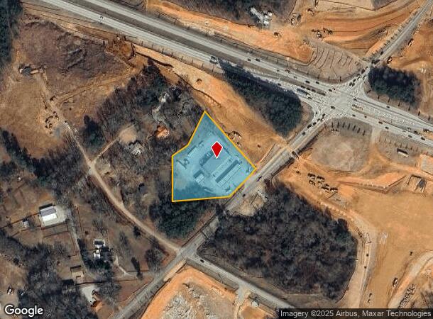
529 Patrick Mill Rd Sw
Atlanta-Sandy Springs-Roswell, GA
River Trace Unit 2
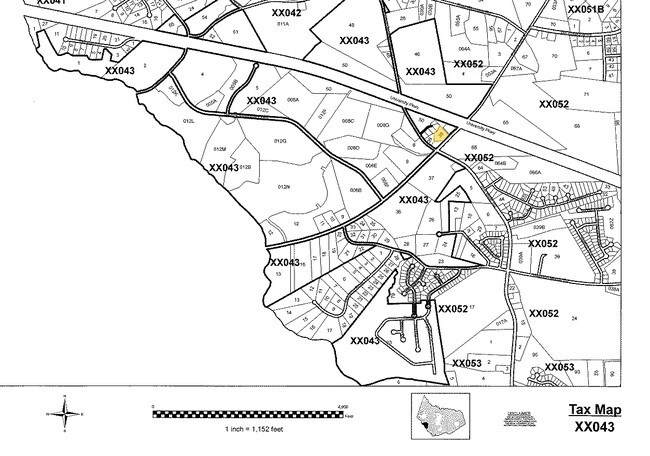
XX043-038
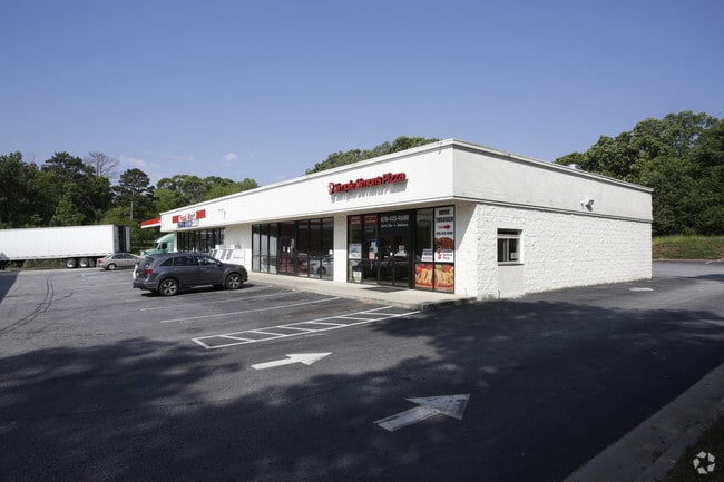
529 PATRICK MILL RD SW
Stripcommercialcenter
Barrow
X
Georgia
13135C0079G
0
2024
2.50 AC
2024
S Barrow
180108
Atlanta
6,600 SF
DEMOGRAPHICS near 529 Patrick Mill Rd Sw
1 Mile
3 Mile
5 Mile
2024 Total Population
1,385
17,832
53,455
2029 Population
1,609
20,376
60,829
Pop Growth 2024-2029
+ 16.17%
+ 14.27%
+ 13.79%
Average Age
33
35
36
2024 Total Households
432
5,758
17,505
HH Growth 2024-2029
+ 16.44%
+ 14.47%
+ 14.18%
Median Household Inc
$84,107
$76,191
$73,808
Avg Household Size
3.20
3.00
3.00
2024 Avg HH Vehicles
2.00
2.00
2.00
Median Home Value
$230,600
$218,721
$236,048
Median Year Built
2006
2001
1999
Nearby Places
Map Layers
Map Styles
 Street
 Aerial
- Restaurants
- Banks
- Shops
- Fitness
- Groceries
SALE & LEASE HISTORY
LISTING DATE
SALE/LEASE

Aug 08, 2018
For Lease
Nearby Properties
Address
Land Use
TOTAL SIZE
Lot Size
Zoning
Address
Land Use
TOTAL SIZE
Lot Size
Zoning
10,128 SF
28.20 AC
R-3
Address
Land Use
TOTAL SIZE
Lot Size
Zoning
420,876 SF
26.80 AC
M-2
Address
Land Use
TOTAL SIZE
Lot Size
Zoning
26,789 SF
35.60 AC
C-3
Address
Land Use
TOTAL SIZE
Lot Size
Zoning
22,320 SF
15.90 AC
R-3
Address
Land Use
TOTAL SIZE
Lot Size
Zoning
305,327 SF
22.10 AC
M-2
Address
Land Use
TOTAL SIZE
Lot Size
Zoning
690,427 SF
156 AC
M-1
Address
Land Use
TOTAL SIZE
Lot Size
Zoning
120,000 SF
142.70 AC
AG
Address
Land Use
TOTAL SIZE
Lot Size
Zoning
301,200 SF
39.20 AC
M-2
Address
Land Use
TOTAL SIZE
Lot Size
Zoning
231,285 SF
34.50 AC
M-2
Address
Land Use
TOTAL SIZE
Lot Size
Zoning
183,060 SF
17.90 AC
M-2
Address
Land Use
TOTAL SIZE
Lot Size
Zoning
167,580 SF
21.80 AC
M-2
Address
Land Use
TOTAL SIZE
Lot Size
Zoning
89,520 SF
14 AC
M-2
Address
Land Use
TOTAL SIZE
Lot Size
Zoning
23,546 SF
24.55 AC
RA200
Address
Land Use
TOTAL SIZE
Lot Size
Zoning
132,156 SF
10.10 AC
C-2
Address
Land Use
TOTAL SIZE
Lot Size
Zoning
79,029 SF
9.70 AC
C-2
Address
Land Use
TOTAL SIZE
Lot Size
Zoning
104,805 SF
12.50 AC
C-3
Address
Land Use
TOTAL SIZE
Lot Size
Zoning
137,200 SF
20 AC
M-2
Address
Land Use
TOTAL SIZE
Lot Size
Zoning
20,660 SF
10.94 AC
RA200
Address
Land Use
TOTAL SIZE
Lot Size
Zoning
1,188 SF
7.60 AC
R-3
Address
Land Use
TOTAL SIZE
Lot Size
Zoning
60,540 SF
79.30 AC
AG
Address
Land Use
TOTAL SIZE
Lot Size
Zoning
38,550 SF
3 AC
C-2
Address
Land Use
TOTAL SIZE
Lot Size
Zoning
55,420 SF
5 AC
C-3
Address
Land Use
TOTAL SIZE
Lot Size
Zoning
69,285 SF
53.10 AC
M-2
Address
Land Use
TOTAL SIZE
Lot Size
Zoning
20,132 SF
1.21 AC
CBD
Address
Land Use
TOTAL SIZE
Lot Size
Zoning
59,898 SF
38.90 AC
M-1
Address
Land Use
TOTAL SIZE
Lot Size
Zoning
64,800 SF
47.30 AC
M-1
Address
Land Use
TOTAL SIZE
Lot Size
Zoning
212.21 AC
RA200
Address
Land Use
TOTAL SIZE
Lot Size
Zoning
153 AC
R100
Address
Land Use
TOTAL SIZE
Lot Size
Zoning
2,398 SF
8.10 AC
R-3
Address
Land Use
TOTAL SIZE
Lot Size
Zoning
56,250 SF
4.70 AC
M-1
The World's #1 Commercial Real Estate Marketplace
Connect with us
© 2025 CoStar Group
The information above has been obtained from sources believed reliable. While we do not doubt its accuracy we have not verified it and make no guarantee, warranty or representation about it. It is your responsibility to independently confirm its accuracy and completeness. Any projections, opinions, assumptions, or estimates used are for example only and do not represent the current or future performance of the property. The value of this transaction to you depends on tax and other factors which should be evaluated by your tax, financial, and legal advisors. You and your advisors should conduct a careful, independent investigation of the property to determine to your satisfaction the suitability of the property for your needs.